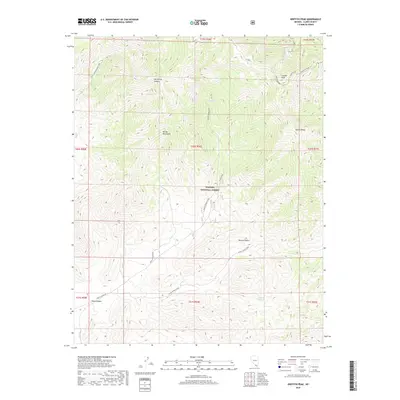
2018 Map of Griffith Peak
USGS Topo · Published 2018About this map
Griffith Peak stands as a prominent high-altitude landmark within the high elevations of the Spring Mountains, anchoring a landscape defined by sharp ridges and deep canyons. This 2018 survey detail shows a network of essential water sources in an otherwise arid environment, including Lees Spring, Trout Springs, and Wild Rose Spring. These natural features are critical to the character of the Toiyabe National Forest, where the transition from high-mountain slopes like Sexton Ridge meets the lower expanses of the Mojave Desert.
Find a feature on this map
30 named features on this map. Tap any name to fly to it.
Don’t see what you’re looking for? This feature index may not catch every label — zoom into the map to look around manually.
Map Details
Editions of this 2018 Griffith Peak Map
This is the sole edition of this map. No revisions or reprints were ever made.
Other maps of this area

1907 · Las Vegas
USGS Topo · 1:250,000

1908 · Las Vegas
USGS Topo · 1:250,000

1954 · Las Vegas
USGS Topo · 1:250,000

1957 · Las Vegas
USGS Topo · 1:250,000

1957 · Mt. Stirling
USGS Topo · 1:62,500

1957 · Charleston Peak
USGS Topo · 1:62,500

1957 · Mountain Springs
USGS Topo · 1:62,500
1958 · Pahrump
USGS Topo · 1:62,500

1959 · Las Vegas
USGS Topo · 1:250,000

1962 · Las Vegas
USGS Topo · 1:250,000