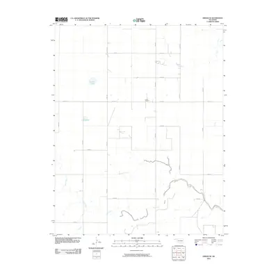
2010 Map of Griggs NE
USGS Topo · Published 2010About this map
Hutsell Cemetery sits at the center of this high-plains landscape, representing a quiet historical anchor amidst an expansive grid of county roads. The terrain is defined by its subtle hydrology, where ephemeral drainage systems like Tepee Creek and the winding course of Sand Creek cut through the panhandle soil. This 2010 survey illustrates the modern agricultural layout of the region, where section lines are strictly adhered to by routes such as e0210 RD and n0540 RD. Small water bodies like Lafaver Lake and Lake Olamar appear as rare landmarks in an otherwise open, rural environment, highlighting the essential role of water management and natural catchments in this part of Oklahoma.
Find a feature on this map
20 named features on this map. Tap any name to fly to it.
Don’t see what you’re looking for? This feature index may not catch every label — zoom into the map to look around manually.
Map Details
Editions of this 2010 Griggs NE Map
This is the sole edition of this map. No revisions or reprints were ever made.
Other maps of this area

1954 · Perryton
USGS Topo · 1:250,000

1954 · Dalhart
USGS Topo · 1:250,000

1958 · Perryton
USGS Topo · 1:250,000

1958 · Dalhart
USGS Topo · 1:250,000

1962 · Dalhart
USGS Topo · 1:250,000

1971 · Griggs SW
USGS Topo · 1:24,000

1971 · Griggs NE
USGS Topo · 1:24,000

1971 · Griggs
USGS Topo · 1:24,000

1971 · Hopkins
USGS Topo · 1:24,000

1971 · Keyes East
USGS Topo · 1:24,000