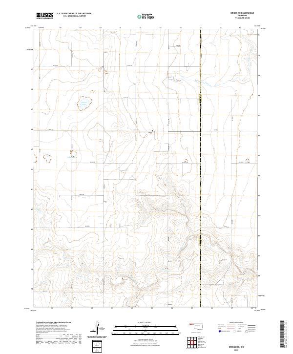
2022 Map of Griggs NE
USGS Topo · Published 2022About this map
Hutsell Cem sits along the northern edge of this high plains region, a key landmark in a landscape defined by seasonal water and a precise section-line road network. The boundary between Cimarron County and Texas County runs north-to-south through the eastern portion of the survey, dividing the land between townships T3N and T2N. Small, isolated bodies of water like Lafaver Lake and Lake Olamar punctuate the arid terrain, while Sand Creek and Tepee Cr carve winding paths through the elevation contours. This modern survey shows how the rural infrastructure, including Roberts Rd and Co Rd U, continues to follow the historic Public Land Survey System grid, maintaining a structural continuity that dates back to the original homesteading of the Oklahoma Panhandle.
Find a feature on this map
31 named features on this map. Tap any name to fly to it.
Don’t see what you’re looking for? This feature index may not catch every label — zoom into the map to look around manually.
Map Details
Editions of this 2022 Griggs NE Map
This is the sole edition of this map. No revisions or reprints were ever made.
Other maps of this area

1954 · Perryton
USGS Topo · 1:250,000

1954 · Dalhart
USGS Topo · 1:250,000

1958 · Perryton
USGS Topo · 1:250,000

1958 · Dalhart
USGS Topo · 1:250,000

1962 · Dalhart
USGS Topo · 1:250,000

1971 · Griggs SW
USGS Topo · 1:24,000

1971 · Griggs NE
USGS Topo · 1:24,000

1971 · Griggs
USGS Topo · 1:24,000

1971 · Hopkins
USGS Topo · 1:24,000

1971 · Keyes East
USGS Topo · 1:24,000