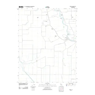
2012 Map of Grimes
USGS Topo · Published 2012About this map
Grimes sits prominently along the eastern edge of this landscape, where the Sacramento River carves a winding path through the Central Valley. The river's influence is evident in the numerous oxbow features and bars, including Ogden Bend, Girdner Bend, and Twentymile Bar. To the west, the land is defined by a complex network of drainage and sloughs, notably the Colusa Basin Drainage Canal and Sycamore Slough, which manage the water levels of this fertile agricultural basin. Small settlements and specialized transport hubs such as Graino and Sycamore Siding suggest a rural economy deeply tied to the land and nearby rail lines.
Find a feature on this map
43 named features on this map. Tap any name to fly to it.
Don’t see what you’re looking for? This feature index may not catch every label — zoom into the map to look around manually.
Map Details
Editions of this 2012 Grimes Map
This is the sole edition of this map. No revisions or reprints were ever made.
Other maps of this area

1888 · Marysville
USGS Topo · 1:125,000

1891 · Marysville
USGS Topo · 1:125,000

1894 · Marysville
USGS Topo · 1:125,000

1895 · Marysville
USGS Topo · 1:125,000

1905 · Harrington
USGS Topo · 1:24,000

1907 · Dunnigan
USGS Topo · 1:62,500

1907 · Colusa
USGS Topo · 1:62,500

1911 · Grimes
USGS Topo · 1:31,680

1912 · Marysville Buttes
USGS Topo · 1:31,680

1912 · Meridian
USGS Topo · 1:31,680