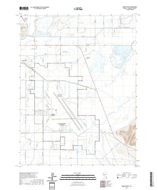
2021 Map of Grimes Point
USGS Topo · Published 2021About this map
The desert landscape of the Lahontan Valley is defined by a complex network of man-made waterways and military installations. The eastern edge of Fallon and the nearby Fallon Station serve as anchors for this region, where the vast Fallon Naval Air Station occupies a significant portion of the central terrain. This landscape is a patchwork of irrigation and drainage infrastructure, with labels like the S Line Canal, A Line Canal, and Lower Diagonal Drain illustrating the concerted effort to manage water in this arid environment. Natural and engineered features coexist, from the heights of Rattlesnake Hill and Eetz Mtn to the water-catchments of S Line Reservoir and Harmon Reservoir. Historical routes and wetlands, such as New River Slough and Pierson Slough, wind through the valley, highlighting the intersection of aviation history, desert reclamation, and Great Basin geography.
Find a feature on this map
85 named features on this map. Tap any name to fly to it.
Don’t see what you’re looking for? This feature index may not catch every label — zoom into the map to look around manually.
Map Details
Editions of this 2021 Grimes Point Map
This is the sole edition of this map. No revisions or reprints were ever made.
Other maps of this area

1908 · Carson Sink
USGS Topo · 1:250,000

1910 · Carson Sink
USGS Topo · 1:250,000

1950 · Stillwater
USGS Topo · 1:62,500

1951 · Carson Lake
USGS Topo · 1:62,500

1951 · Soda Lake
USGS Topo · 1:62,500

1951 · Fallon
USGS Topo · 1:62,500

1957 · Reno
USGS Topo · 1:250,000

1959 · Reno
USGS Topo · 1:250,000

1960 · Reno
USGS Topo · 1:250,000

1979 · Carson Sink
USGS Topo · 1:100,000