
1903 Map of Grindstone
USGS Topo · Published 1903About this map
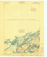
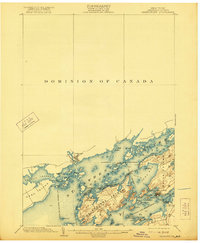
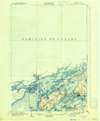
Grindstone Island and the intricate archipelago of the Thousand Islands dominate this international border survey, conducted just after the turn of the century by H.M. Wilson and W.H. Lovell. The landscape is defined by the vital shipping lanes of the St. Lawrence River, where the Clayton and Gananoque Steamboat Line and the St. Lawrence River Steamboat Company provided essential transit between the mainland and island communities. On the American side, the established Victorian-era resort of Thousand Island Park sits at the southern tip of Wellesley Island, while the northern shore features the Canadian settlement of Gananoque. Numerous navigational aids, including Jackstraw L.H. and Spectacle Shoal L.H., underscore the era's reliance on river commerce. Local industry is represented by a Quarry on the western edge of Grindstone, contrasting with the leisure-focused atmosphere of Grandview Park.
Find a feature on this map
52 named features on this map. Tap any name to fly to it.
Don’t see what you’re looking for? This feature index may not catch every label — zoom into the map to look around manually.
Map Details
Editions of this 1903 Grindstone Map
4 editions found
Other maps of this area

1895 · Cape Vincent
USGS Topo · 1:62,500

1900 · Clayton
USGS Topo · 1:62,500

1903 · Clayton
USGS Topo · 1:62,500

1903 · Alexandria Bay
USGS Topo · 1:62,500

1903 · Theresa
USGS Topo · 1:62,500

1942 · Cape Vincent North
USGS Topo · 1:31,680

1942 · Sawmill Bay
USGS Topo · 1:31,680

1942 · Clayton
USGS Topo · 1:24,000

1943 · Thousand Island Park
USGS Topo · 1:31,680

1943 · Clayton
USGS Topo · 1:31,680