
1984 Map of Grinnell
USGS Topo · Published 1985About this map
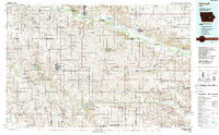
The Sac and Fox Indian Reservation along the Iowa River stands as a central cultural and geographical fixture in this 1980s portrait of central Iowa. The landscape is defined by the rigid grid of agricultural sections and the strategic path of the Chicago and North Western railroad, which links historic prairie towns like Tama, Chelsea, and Belle Plaine. This era shows a significant emphasis on conservation and public land use, evidenced by the extensive Otter Creek Marsh State Wildlife Refuge and the Rock Creek State Park. In the southern half of the region, the headwaters of the North English River and Deep River carve through the terrain near settlements such as Montezuma and Searsboro. Significant water features like Lake Ponderosa and Diamond Lake provide recreation and drainage within this productive corridor of the Iowa heartland.
Find a feature on this map
122 named features on this map. Tap any name to fly to it.
Don’t see what you’re looking for? This feature index may not catch every label — zoom into the map to look around manually.
Map Details
Editions of this 1984 Grinnell Map
2 editions found
Historical Maps of Marshalltown Through Time
1 maps found