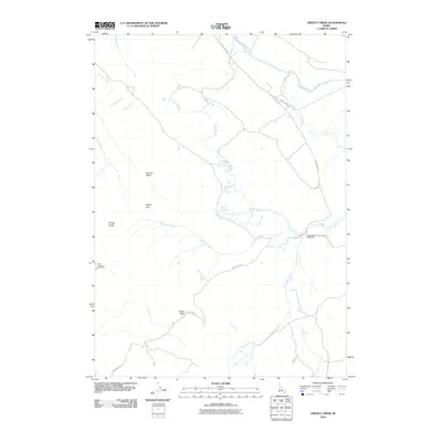
2010 Map of Grizzly Creek
USGS Topo · Published 2010About this map
Grizzly Creek and its many tributaries, including Sawmill Creek and Thompson Creek, carve through this high-country landscape in Caribou County. The area is defined by its ranching and grazing infrastructure, anchored by the Chesterfield Cow Camp in the east. Local water sources like Dairy Springs provided essential points of relief for livestock moving between the higher elevations and the valley floor. The map documents a network of unpaved access routes such as Cow Camp Rd and Corral Creek Rd, which connect the scattered camps and pastures.
Find a feature on this map
17 named features on this map. Tap any name to fly to it.
Don’t see what you’re looking for? This feature index may not catch every label — zoom into the map to look around manually.
Map Details
Editions of this 2010 Grizzly Creek Map
This is the sole edition of this map. No revisions or reprints were ever made.
Other maps of this area

1914 · Henry
USGS Topo · 1:48,000

1916 · Henry
USGS Topo · 1:62,500

1917 · Portneuf
USGS Topo · 1:62,500

1917 · Cranes Flat
USGS Topo · 1:62,500

1918 · Paradise Valley
USGS Topo · 1:62,500

1955 · Driggs
USGS Topo · 1:250,000

1955 · Preston
USGS Topo · 1:250,000

1958 · Driggs
USGS Topo · 1:250,000

1958 · Preston
USGS Topo · 1:250,000

1962 · Driggs
USGS Topo · 1:250,000