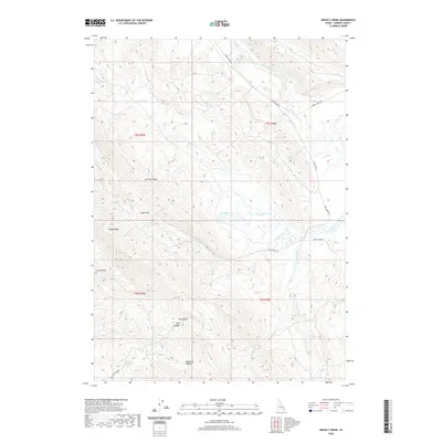
2020 Map of Grizzly Creek
USGS Topo · Published 2020About this map
Dairy Springs and Millward Spring punctuate this high-elevation landscape in Caribou County, where the headwaters of numerous creeks carve a complex system of ridges and canyons. The northern reaches are defined by the Blackfoot River and its confluence with Corral Cr, while further south, Grizzly Cr and Sawmill Cr dominate the drainage patterns. The topography is notably marked by geological features such as Devils Gate and the prominent Sawmill Ridge, which separates distinct creek basins. A network of unimproved roads, including Cow Camp Rd and its various spurs, provides access through the high passes like Swaps Pass. This 2020 survey reveals a landscape of high-country ranching and transit, where named canyons like Pole Canyon and Higginson Canyon speak to the area's local geography and historical land use.
Find a feature on this map
26 named features on this map. Tap any name to fly to it.
Don’t see what you’re looking for? This feature index may not catch every label — zoom into the map to look around manually.
Map Details
Editions of this 2020 Grizzly Creek Map
This is the sole edition of this map. No revisions or reprints were ever made.
Other maps of this area

1914 · Henry
USGS Topo · 1:48,000

1916 · Henry
USGS Topo · 1:62,500

1917 · Portneuf
USGS Topo · 1:62,500

1917 · Cranes Flat
USGS Topo · 1:62,500

1918 · Paradise Valley
USGS Topo · 1:62,500

1955 · Driggs
USGS Topo · 1:250,000

1955 · Preston
USGS Topo · 1:250,000

1958 · Driggs
USGS Topo · 1:250,000

1958 · Preston
USGS Topo · 1:250,000

1962 · Driggs
USGS Topo · 1:250,000