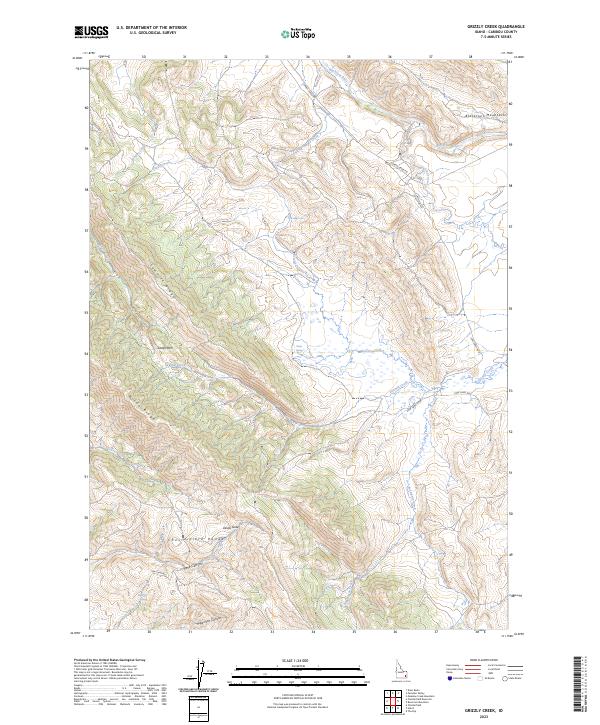
2023 Map of Grizzly Creek
USGS Topo · Published 2023About this map
The Chesterfield Range and the eastern slopes of the Blackfoot Mountains define the high country of this Caribou County landscape. Modern ranching and forest access are facilitated by a network of rural routes including Corral Creek Rd and several branches of Cow Camp Rd, which navigate the complex terrain. The drainage patterns are dominated by the Blackfoot River in the north and the namesake Grizzly Creek, with numerous smaller seasonal flows like Sunday Creek and Thompson Creek carving deep canyons into the ridges. Prominent landmarks such as Devils Gate and Swaps Pass mark natural transit points through the hills. Water sources such as Dairy Springs and Millard Spring provide vital points of interest for local land use in an area characterized by significant topographic relief and prominent ridges like Sawmill Ridge and Windy Ridge.
Find a feature on this map
26 named features on this map. Tap any name to fly to it.
Don’t see what you’re looking for? This feature index may not catch every label — zoom into the map to look around manually.
Map Details
Editions of this 2023 Grizzly Creek Map
This is the sole edition of this map. No revisions or reprints were ever made.
Other maps of this area

1914 · Henry
USGS Topo · 1:48,000

1916 · Henry
USGS Topo · 1:62,500

1917 · Portneuf
USGS Topo · 1:62,500

1917 · Cranes Flat
USGS Topo · 1:62,500

1918 · Paradise Valley
USGS Topo · 1:62,500

1955 · Driggs
USGS Topo · 1:250,000

1955 · Preston
USGS Topo · 1:250,000

1958 · Driggs
USGS Topo · 1:250,000

1958 · Preston
USGS Topo · 1:250,000

1962 · Driggs
USGS Topo · 1:250,000