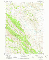
1981 Map of Grizzly Creek
USGS Topo · Published 1982About this map
The Chesterfield Range dominates this corner of Idaho, with its high-elevation terrain carved by deep drainages and cattle-country outposts. Settled into the eastern foothills near where Grizzly Creek meets Thompson Creek, the Chesterfield Cow Camp serves as a lone marker of human occupation in a landscape otherwise defined by topography and hydrology. To the west, the Sawmill Ridge provides a steep backdrop to the various named springs like Dairy Spring and Millward Spring that feed into the larger river systems.
Find a feature on this map
24 named features on this map. Tap any name to fly to it.
Don’t see what you’re looking for? This feature index may not catch every label — zoom into the map to look around manually.
Map Details
Editions of this 1981 Grizzly Creek Map
This is the sole edition of this map. No revisions or reprints were ever made.
Other maps of this area

1914 · Henry
USGS Topo · 1:48,000

1916 · Henry
USGS Topo · 1:62,500

1917 · Portneuf
USGS Topo · 1:62,500

1917 · Cranes Flat
USGS Topo · 1:62,500

1918 · Paradise Valley
USGS Topo · 1:62,500

1955 · Driggs
USGS Topo · 1:250,000

1955 · Preston
USGS Topo · 1:250,000

1958 · Driggs
USGS Topo · 1:250,000

1958 · Preston
USGS Topo · 1:250,000

1962 · Driggs
USGS Topo · 1:250,000