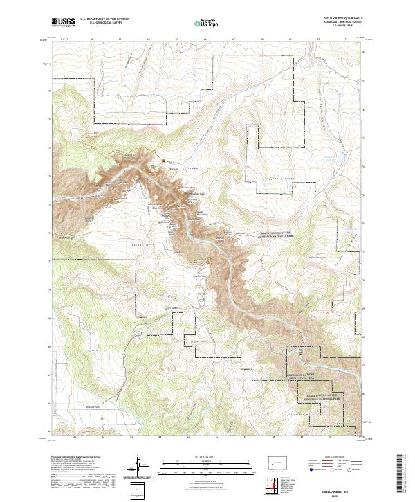
2022 Map of Grizzly Ridge
USGS Topo · Published 2022About this map
The Black Canyon of the Gunnison National Park dominates this terrain, where the Gunnison River has carved a dramatic vertical landscape through Vernal Mesa. Significant engineering features are visible, most notably the Gunnison Tunnel, which diverts water from the river beneath the canyon walls to support agricultural life in Bostwick Park. This area showcases the 20th-century irrigation infrastructure required to settle the region, including the Vernal Mesa Ditch, W Lateral, and E Lateral. High vantage points such as Painted Wall, Chasm View, and Exclamation Point line the canyon rim, while the eastern portion of the map transitions into the Curecanti National Recreation Area near Poison Spring Reservoir.
Find a feature on this map
78 named features on this map. Tap any name to fly to it.
Don’t see what you’re looking for? This feature index may not catch every label — zoom into the map to look around manually.
Map Details
Editions of this 2022 Grizzly Ridge Map
This is the sole edition of this map. No revisions or reprints were ever made.
Other maps of this area

1909 · Montrose
USGS Topo · 1:125,000

1911 · Montrose
USGS Topo · 1:125,000

1955 · Black Ridge
USGS Topo · 1:24,000

1955 · Red Rock Canyon
USGS Topo · 1:24,000

1956 · Cimarron
USGS Topo · 1:24,000

1956 · Montrose
USGS Topo · 1:250,000

1957 · Cathedral Peak
USGS Topo · 1:24,000

1957 · Cerro Summit
USGS Topo · 1:24,000

1957 · Grizzly Ridge
USGS Topo · 1:24,000

1959 · Montrose
USGS Topo · 1:250,000