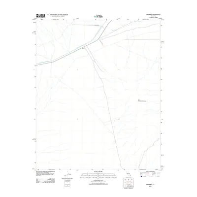
2012 Map of Grommet
USGS Topo · Published 2012About this map
The settlement of Grommet sits at a critical infrastructure junction where the Colorado River Aqueduct traverses the California desert. This 2012 survey illustrates the path of the massive waterway as it cuts through the arid landscape toward the coast, shadowed by Radio Tower Rd. To the east and south, the terrain rises into the West Riverside Mountains, a prominent landform that defines the eastern edge of this quadrangle. The hydrology of the area is dominated by the seasonal Vidal Wash, which meanders across the northern section of the map. This topographic record captures the intersection of mid-century engineering and the enduring desert geography of San Bernardino County.
Find a feature on this map
6 named features on this map. Tap any name to fly to it.
Don’t see what you’re looking for? This feature index may not catch every label — zoom into the map to look around manually.
Map Details
Editions of this 2012 Grommet Map
This is the sole edition of this map. No revisions or reprints were ever made.
Other maps of this area

1942 · Blythe
USGS Topo · 1:250,000

1943 · Vidal
USGS Topo · 1:62,500

1945 · Big Maria Mtns
USGS Topo · 1:62,500

1945 · Midland
USGS Topo · 1:62,500

1949 · Vidal
USGS Topo · 1:62,500

1950 · Vidal
USGS Topo · 1:62,500

1951 · Big Maria Mts
USGS Topo · 1:62,500

1952 · Midland
USGS Topo · 1:62,500

1954 · Salton Sea
USGS Topo · 1:250,000

1954 · Needles
USGS Topo · 1:250,000