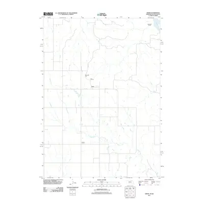
2011 Map of Gross
USGS Topo · Published 2011About this map
The small settlement of Gross anchors this Boyd County landscape just south of the South Dakota border, positioned near the intersection of Co Hwy 40 and Oil Co Rd. This area of northern Nebraska is defined by the winding course of Whisky Creek, which meanders through the central and southern portions of the quadrangle before reaching the Missouri River in the northeast corner. For genealogists and local historians, the map provides precise locations for the Gross Cemetery near the town site and the Rosedale Cemetery further south. The topography is marked by significant elevations like Ninemile Hill and the drainage of Ninemile Gulch, illustrating the transition from upland prairie to the river valley. A grid of rural roads, including Prairie Ave and 2nd Ave, structures the agricultural land surrounding the sparsely populated village.
Find a feature on this map
11 named features on this map. Tap any name to fly to it.
Don’t see what you’re looking for? This feature index may not catch every label — zoom into the map to look around manually.
Map Details
Editions of this 2011 Gross Map
This is the sole edition of this map. No revisions or reprints were ever made.
Other maps of this area

1950 · Lynch
USGS Topo · 1:24,000

1951 · Bristow
USGS Topo · 1:24,000

1952 · Spencer South
USGS Topo · 1:24,000

1955 · Mitchell
USGS Topo · 1:250,000

1955 · O'Neill
USGS Topo · 1:250,000

1959 · O'Neill
USGS Topo · 1:250,000

1959 · Mitchell
USGS Topo · 1:250,000

1964 · Fort Randall Dam
USGS Topo · 1:24,000

1964 · Gross
USGS Topo · 1:24,000

1964 · Lake Andes SW
USGS Topo · 1:24,000