
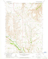
1964 Map of Gross
USGS Topo · Published 1965About this map
The Old Fort Randall Military Road slices diagonally across this Nebraska borderland, marking a historical corridor through Boyd County and Gregory County. This 1960s survey captures a landscape defined by the drainage systems of Whisky Creek and Ninemile Gulch as they descend toward the Missouri River in the northeast corner. The small settlement of Gross is documented here alongside its corresponding Gross Cem, serving as a focal point for the surrounding rural sections of Morton and Mullen townships.
Find a feature on this map
19 named features on this map. Tap any name to fly to it.
Don’t see what you’re looking for? This feature index may not catch every label — zoom into the map to look around manually.
Map Details
Editions of this 1964 Gross Map
This is the sole edition of this map. No revisions or reprints were ever made.
Other maps of this area

1950 · Lynch
USGS Topo · 1:24,000

1951 · Bristow
USGS Topo · 1:24,000

1952 · Spencer South
USGS Topo · 1:24,000

1955 · Mitchell
USGS Topo · 1:250,000

1955 · O'Neill
USGS Topo · 1:250,000

1959 · O'Neill
USGS Topo · 1:250,000

1959 · Mitchell
USGS Topo · 1:250,000

1964 · Fort Randall Dam
USGS Topo · 1:24,000

1964 · Lake Andes SW
USGS Topo · 1:24,000
1964 · Spencer North
USGS Topo · 1:24,000