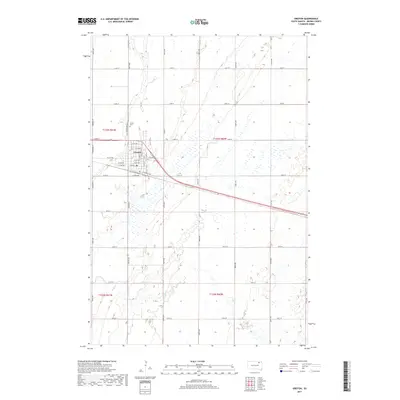
2017 Map of Groton
USGS Topo · Published 2017About this map
Groton serves as the central hub for this portion of Brown County, situated at the intersection of a grid-iron road network and a prominent rail line marked by E Railroad Ave. The town is organized around a traditional street plan, featuring a mix of residential and transit-focused avenues such as E Aspen Ave and E 5th Ave. North of the main settlement, the Groton Cem provides a point of genealogical interest, positioned along the N Broadway Acc. The surrounding landscape is characterized by its agricultural character, dominated by a vast section-line road system including 405th Ave through 411th Ave. In the southwestern quadrant, the natural drainage of Mud Cr meanders through the prairie, contrasting with the strictly rectilinear township boundaries of t123n r61w and t122n r61w.
Find a feature on this map
40 named features on this map. Tap any name to fly to it.
Don’t see what you’re looking for? This feature index may not catch every label — zoom into the map to look around manually.
Map Details
Editions of this 2017 Groton Map
This is the sole edition of this map. No revisions or reprints were ever made.
Other maps of this area

1895 · Aberdeen
USGS Topo · 1:125,000

1896 · Columbia
USGS Topo · 1:125,000

1952 · Huffton
USGS Topo · 1:24,000

1952 · Putney
USGS Topo · 1:24,000

1953 · Groton SW
USGS Topo · 1:24,000

1953 · Milbank
USGS Topo · 1:250,000

1954 · Groton
USGS Topo · 1:24,000

1954 · James
USGS Topo · 1:24,000

1954 · Ferney
USGS Topo · 1:24,000

1954 · Aberdeen
USGS Topo · 1:250,000