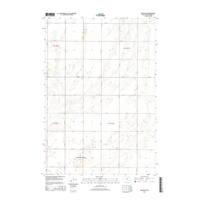
2015 Map of Groton SW
USGS Topo · Published 2015About this map
Hutterville Colony serves as the primary focal point of this rural landscape in Brown County, south of Groton. The terrain is defined by the subtle drainage patterns of Mud Cr and Dry Run, which wind through a strictly organized grid of agricultural section lines. This network, comprised of numbered avenues such as 401st Ave and streets like 145th St, illustrates the persistent influence of the Public Land Survey System on South Dakota's development. The map reveals the relationship between communal settlement patterns and the surrounding prairie environment, as indicated by the township and range designations like t121n r61w. This survey is a record of the area's late-twentieth and early-twenty-first-century agrarian infrastructure.
Find a feature on this map
22 named features on this map. Tap any name to fly to it.
Don’t see what you’re looking for? This feature index may not catch every label — zoom into the map to look around manually.
Map Details
Editions of this 2015 Groton SW Map
This is the sole edition of this map. No revisions or reprints were ever made.
Other maps of this area

1894 · Conde
USGS Topo · 1:62,500

1895 · Aberdeen
USGS Topo · 1:125,000

1953 · Brentford
USGS Topo · 1:24,000

1953 · Stratford
USGS Topo · 1:24,000

1953 · Groton SW
USGS Topo · 1:24,000

1954 · Bath
USGS Topo · 1:24,000

1954 · Groton
USGS Topo · 1:24,000

1954 · James
USGS Topo · 1:24,000

1954 · Ferney
USGS Topo · 1:24,000

1954 · Aberdeen
USGS Topo · 1:250,000
Featured Places
- Hutterville Colony, SD
- Gem Township, SD
- Garden Prairie Township, SD
- West Hanson Township, SD
- East Rondell Township, SD