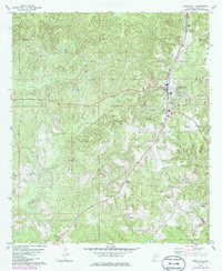
1978 Map of Grove Hill
USGS Topo · Published 1986About this map
The town of Grove Hill serves as the central hub of this Clarke County landscape, showing the community as it transitioned through the mid-1970s into the 1980s. A dense network of family and community burial grounds, including Magnolia Cemetery and Mathews Cemetery, highlights the area's deep genealogical roots. The topography is defined by the winding paths of Tattilaba Creek and Rabbit Creek, while the local economy is evidenced by several Gravel Pits and the proximity of the Municipal Airport. Landmarks such as the Grove Hill Lookout Tower and the Drive-in Theater provide a look at the mid-century infrastructure and social spaces of the era. The presence of rural congregations like Union Church and Tompkins Church illustrates the dispersed settlement pattern typical of the Alabama coastal plain during this period of development.
Find a feature on this map
28 named features on this map. Tap any name to fly to it.
Don’t see what you’re looking for? This feature index may not catch every label — zoom into the map to look around manually.
Map Details
Editions of this 1978 Grove Hill Map
2 editions found
Other maps of this area

1953 · Andalusia
USGS Topo · 1:250,000

1957 · Andalusia
USGS Topo · 1:250,000

1972 · Whatley
USGS Topo · 1:24,000

1972 · Suggsville
USGS Topo · 1:24,000

1973 · Fulton East
USGS Topo · 1:24,000

1978 · Jackson
USGS Topo · 1:24,000

1978 · McEntyre
USGS Topo · 1:24,000

1978 · Winn
USGS Topo · 1:24,000
1978 · Grove Hill
USGS Topo · 1:24,000
1978 · Fulton West
USGS Topo · 1:24,000