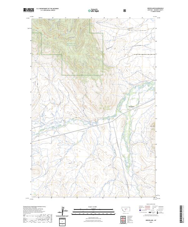
2024 Map of Groveland
USGS Topo · Published 2024About this map
The Lewis & Clark National Forest defines the western and central reaches of this Montana landscape, where the high-altitude topography of Whetstone Ridge and Pasture Gulch gives way to the open ranching country of the Musselshell valley. In the eastern plains, the small community of Groveland serves as a focal point near the confluence of Willow Creek and the South Fork Musselshell River. The land is deeply etched by a network of seasonal and perennial waterways including Cottonwood Creek, Gillis Creek, and Muddy Creek, which drain the surrounding foothills. Human presence is marked by primitive routes such as the Whetstone Ridge Trl and established ranching corridors like 71 Ranch Rd. To the southeast, the prominent elevation of Gordon Butt stands as a distinct landmark overlooking the lower drainages and canyons like Green Canyon.
Find a feature on this map
22 named features on this map. Tap any name to fly to it.
Don’t see what you’re looking for? This feature index may not catch every label — zoom into the map to look around manually.
Map Details
Editions of this 2024 Groveland Map
This is the sole edition of this map. No revisions or reprints were ever made.
Other maps of this area

1886 · Little Belt Mts.
USGS Topo · 1:250,000

1894 · Little Belt Mts.
USGS Topo · 1:250,000

1897 · Little Belt Mts.
USGS Topo · 1:250,000

1898 · Little Belt Mts.
USGS Topo · 1:250,000

1902 · Little Belt Mts.
USGS Topo · 1:250,000

1948 · White Sulphur Springs
USGS Topo · 1:250,000

1951 · Rimrock Divide
USGS Topo · 1:24,000

1958 · White Sulphur Springs
USGS Topo · 1:250,000

1961 · White Sulphur Springs
USGS Topo · 1:250,000

1965 · White Sulphur Springs
USGS Topo · 1:250,000