
1952 Map of Grover
USGS Topo · Published 1957About this map
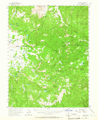
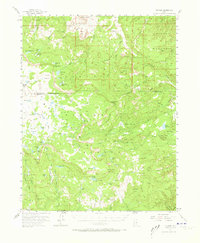
Grover sits at the northern edge of this high-altitude landscape, where the settlement gives way to the deep canyons and high plateaus of the Dixie National Forest. The map reveals a highly active working landscape in the early 1950s, dotted with features like a Sawmill, a Tunnel, and a Windmill. High-country water management is evident through the numerous high-elevation reservoirs and lakes, including Donkey Reservoir and Oak Creek Reservoir. Public land administration is anchored by the Wildcat Ranger Sta and the Oak Creek Forest Camp, while naming conventions like Stink Flats, Beef Meadows, and Haws Pasture reflect the region's ranching and grazing heritage. The complex topography spans from the high peaks of The Baldys to the secluded Happy Valley, illustrating the intersection of resource extraction and early recreational use in the southern Utah mountains.
Find a feature on this map
92 named features on this map. Tap any name to fly to it.
Don’t see what you’re looking for? This feature index may not catch every label — zoom into the map to look around manually.
Map Details
Editions of this 1952 Grover Map
3 editions found
Other maps of this area

1885 · Fish Lake
USGS Topo · 1:250,000

1886 · Escalante
USGS Topo · 1:250,000

1896 · Fish Lake
USGS Topo · 1:250,000

1952 · Notom 3 SW
USGS Topo · 1:24,000

1952 · Loa 1 SE
USGS Topo · 1:24,000

1952 · Notom 3 NW
USGS Topo · 1:24,000

1952 · Notom 2 SE
USGS Topo · 1:24,000

1952 · Notom 2 SW
USGS Topo · 1:24,000

1952 · Notom 4 NW
USGS Topo · 1:24,000

1952 · Notom 4 SW
USGS Topo · 1:24,000