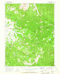
1952 Map of Grover
USGS Topo · Published 1966About this map
Grover sits at the northern edge of this high-altitude landscape where the Dixie National Forest meets the desert geology of Wayne and Garfield counties. The terrain is defined by a dense concentration of water sources, from the deep Blind Lake and Fish Creek Lake to high-elevation pastures like Beef Meadows and Boulder Meadows. Human presence in the early 1950s is marked by essential forest infrastructure, including the Wildcat Ranger Sta and the Oak Creek Forest Camp. A single shaft noted in the Miners Mountain area points to local prospecting interests, while the rugged Cocks Comb and Chokecherry Point provided critical landmarks for navigation across the plateau. The map captures the area before modern development, showing a network of primitive roads like Chokecherry and isolated grazing lands such as Wildcat Pasture and Pleasant Pasture.
Find a feature on this map
90 named features on this map. Tap any name to fly to it.
Don’t see what you’re looking for? This feature index may not catch every label — zoom into the map to look around manually.
Map Details
Editions of this 1952 Grover Map
3 editions found

Other maps of this area

1885 · Fish Lake
USGS Topo · 1:250,000

1886 · Escalante
USGS Topo · 1:250,000

1896 · Fish Lake
USGS Topo · 1:250,000

1952 · Notom 3 SW
USGS Topo · 1:24,000

1952 · Loa 1 SE
USGS Topo · 1:24,000

1952 · Notom 3 NW
USGS Topo · 1:24,000

1952 · Notom 2 SE
USGS Topo · 1:24,000

1952 · Notom 2 SW
USGS Topo · 1:24,000

1952 · Notom 4 NW
USGS Topo · 1:24,000

1952 · Notom 4 SW
USGS Topo · 1:24,000