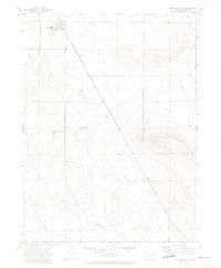
1972 Map of Grover South
USGS Topo · Published 1974About this map
Grover serves as the primary hub of this Weld County landscape in the early 1970s, where the local High Sch and Rodeo Ground reflect the community's social and agricultural focus. The Burlington Northern railroad bisects the terrain, tracing a diagonal path from the northwest toward the southeast, supporting the regional movement of goods.
Find a feature on this map
9 named features on this map. Tap any name to fly to it.
Don’t see what you’re looking for? This feature index may not catch every label — zoom into the map to look around manually.
Map Details
Editions of this 1972 Grover South Map
2 editions found
Other maps of this area

1954 · Greeley
USGS Topo · 1:250,000

1957 · Greeley
USGS Topo · 1:250,000

1958 · Greeley
USGS Topo · 1:250,000

1961 · Greeley
USGS Topo · 1:250,000

1964 · Greeley
USGS Topo · 1:250,000

1965 · Greeley
USGS Topo · 1:250,000
1972 · Grover North
USGS Topo · 1:24,000

1972 · Briggsdale
USGS Topo · 1:24,000

1972 · Keota NW
USGS Topo · 1:24,000
1972 · Hereford
USGS Topo · 1:24,000