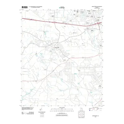
2011 Map of Grovetown
USGS Topo · Published 2011About this map
Grovetown sits at the heart of this Columbia County landscape, serving as a hub between the suburban growth of Sugarcreek and the northern reaches of the Fort Gordon military installation. The map reveals a transition from traditional rural homesteads, marked by family burial grounds like the Beale Cemetery and Inglett Cemetery, to modern residential developments such as Lewiston Downs and Belglade.
Find a feature on this map
92 named features on this map. Tap any name to fly to it.
Don’t see what you’re looking for? This feature index may not catch every label — zoom into the map to look around manually.
Map Details
Editions of this 2011 Grovetown Map
This is the sole edition of this map. No revisions or reprints were ever made.
Other maps of this area

1892 · Mc Cormick
USGS Topo · 1:125,000

1912 · Mc Cormick
USGS Topo · 1:125,000

1920 · Clarks Hill
USGS Topo · 1:48,000

1921 · Clarks Hill
USGS Topo · 1:62,500

1921 · Appling
USGS Topo · 1:62,500

1922 · Harlem
USGS Topo · 1:62,500

1922 · Hephzibah
USGS Topo · 1:62,500

1941 · Clarks Hill
USGS Topo · 1:62,500

1942 · Clarks Hill
USGS Topo · 1:62,500

1943 · Appling
USGS Topo · 1:62,500