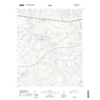
2020 Map of Grovetown
USGS Topo · Published 2020About this map
Grovetown and its surrounding suburbs in Columbia and Richmond counties are captured here as a modern landscape defined by a complex network of residential subdivisions and historical family burials. The terrain is marked by numerous small impoundments such as Wells Lake, Wilkerson Lake, and Thomas Lake, which sit at the headwaters of the drainage system for Spirit Creek and its various tributaries. This 2020 record reflects the continued growth of the Greater Augusta area, where new developments like those along William Few Pkwy exist alongside legacy sites. Genealogists will find several small burial grounds scattered across the landscape, including Newman Cem, Beale Cem, and King Cem. The industrial and transit corridor remains centered on the CSX Transportation rail line, which cuts through the heart of the settlement, while the transition from developed neighborhoods to managed water bodies like Maxwell Lake provides a clear view of the region's current hydrological management.
Find a feature on this map
297 named features on this map. Tap any name to fly to it.
Don’t see what you’re looking for? This feature index may not catch every label — zoom into the map to look around manually.
Map Details
Editions of this 2020 Grovetown Map
This is the sole edition of this map. No revisions or reprints were ever made.
Other maps of this area

1892 · Mc Cormick
USGS Topo · 1:125,000

1912 · Mc Cormick
USGS Topo · 1:125,000

1920 · Clarks Hill
USGS Topo · 1:48,000

1921 · Clarks Hill
USGS Topo · 1:62,500

1921 · Appling
USGS Topo · 1:62,500

1922 · Harlem
USGS Topo · 1:62,500

1922 · Hephzibah
USGS Topo · 1:62,500

1941 · Clarks Hill
USGS Topo · 1:62,500

1942 · Clarks Hill
USGS Topo · 1:62,500

1943 · Appling
USGS Topo · 1:62,500