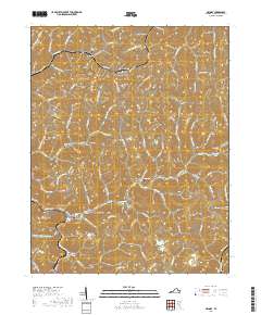
2019 Map of Grundy
USGS Topo · Published 2019About this map
The Buchanan County Courthouse sits at the heart of Grundy, where the narrow valley of the Levisa Fork meets the junction of Slate Cr. This 2019 survey illustrates a landscape of deep hollows and ridgelines, where development is tightly confined to the winding valley floors. The town serves as a regional hub, evidenced by the presence of the Appalachian School of Law and administrative centers.
Find a feature on this map
91 named features on this map. Tap any name to fly to it.
Don’t see what you’re looking for? This feature index may not catch every label — zoom into the map to look around manually.
Map Details
Editions of this 2019 Grundy Map
This is the sole edition of this map. No revisions or reprints were ever made.
Other maps of this area

1886 · Grundy
USGS Topo · 1:125,000

1890 · Grundy
USGS Topo · 1:125,000

1891 · Tazewell
USGS Topo · 1:125,000

1892 · Grundy
USGS Topo · 1:125,000

1895 · Tazewell
USGS Topo · 1:125,000

1897 · Tazewell
USGS Topo · 1:125,000

1910 · Iaeger
USGS Topo · 1:48,000

1912 · Iaeger
USGS Topo · 1:62,500

1914 · Bucu
USGS Topo · 1:48,000

1914 · Iaeger
USGS Topo · 1:48,000