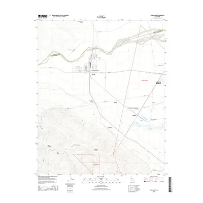
2015 Map of Guadalupe
USGS Topo · Published 2015About this map
The Guadalupe townsite serves as the central hub of this coastal agricultural landscape, situated just south of the Santa Maria River and the San Luis Obispo County line. The settlement pattern reflects the area's industrial and agricultural heritage, with numerous rail-associated locations such as Betteravia Junction, Barsug, and Bragur dotting the valley floor. To the east, the edge of Santa Maria begins to encroach upon the open fields, while the southern portion of the map transitions into the high relief of the Casmalia Hills and Point Sal Ridge.
Find a feature on this map
46 named features on this map. Tap any name to fly to it.
Don’t see what you’re looking for? This feature index may not catch every label — zoom into the map to look around manually.
Map Details
Editions of this 2015 Guadalupe Map
This is the sole edition of this map. No revisions or reprints were ever made.
Other maps of this area

1897 · Arroyo Grande
USGS Topo · 1:62,500

1900 · San Luis
USGS Topo · 1:125,000

1905 · Guadalupe
USGS Topo · 1:125,000

1905 · Lompoc
USGS Topo · 1:125,000

1922 · Nipomo
USGS Topo · 1:62,500

1942 · Guadalupe
USGS Topo · 1:125,000

1942 · Lompoc
USGS Topo · 1:125,000

1942 · Arroyo Grande
USGS Topo · 1:62,500

1942 · Santa Maria
USGS Topo · 1:62,500

1942 · Point Sal
USGS Topo · 1:62,500