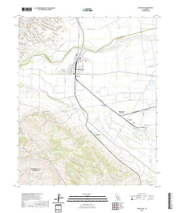
2021 Map of Guadalupe
USGS Topo · Published 2021About this map
Guadalupe anchors this coastal agricultural landscape where the Santa Maria River forms the boundary between San Luis Obispo and Santa Barbara counties. The town's grid is dense with named streets like Olivera St and Campodonico Ave, reflecting a settled community surrounded by the productive Santa Maria Valley. To the south, the topography shifts dramatically into the Casmalia Hills and the slopes of Mt Lospe, carved by Casmalia Canyon. Industrial and agricultural transport is evidenced by the Santa Maria Valley railroad line, which connects several small stations and sidings such as Barsug, Bragur, and Waldorf. The map also captures the vicinity of Betteravia and its namesake Guadalupe Lake, providing a detailed view of the regional infrastructure supporting the area's farming and oil heritage.
Find a feature on this map
62 named features on this map. Tap any name to fly to it.
Don’t see what you’re looking for? This feature index may not catch every label — zoom into the map to look around manually.
Map Details
Editions of this 2021 Guadalupe Map
This is the sole edition of this map. No revisions or reprints were ever made.
Other maps of this area

1897 · Arroyo Grande
USGS Topo · 1:62,500

1900 · San Luis
USGS Topo · 1:125,000

1905 · Guadalupe
USGS Topo · 1:125,000

1905 · Lompoc
USGS Topo · 1:125,000

1922 · Nipomo
USGS Topo · 1:62,500

1942 · Guadalupe
USGS Topo · 1:125,000

1942 · Lompoc
USGS Topo · 1:125,000

1942 · Arroyo Grande
USGS Topo · 1:62,500

1942 · Santa Maria
USGS Topo · 1:62,500

1942 · Point Sal
USGS Topo · 1:62,500