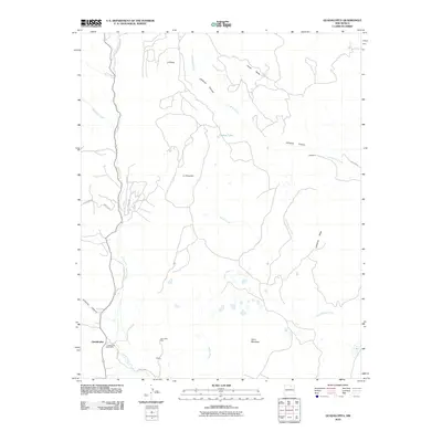
2010 Map of Guadalupita
USGS Topo · Published 2010About this map
Guadalupita serves as the primary settlement center for this portion of Mora County, characterized by the winding path of Coyote Creek and the high plateaus of Ocate Mesa. The landscape is a network of canyons and mesas, where local resource extraction is evidenced by the John Hays Mine and small ranching hubs like La Mesa and La Chuacha. Local infrastructure is concentrated in the southwest corner, anchored by the Guadalupita Post Office and the intersection of S R 518 and Coyote Rd.
Find a feature on this map
25 named features on this map. Tap any name to fly to it.
Don’t see what you’re looking for? This feature index may not catch every label — zoom into the map to look around manually.
Map Details
Editions of this 2010 Guadalupita Map
This is the sole edition of this map. No revisions or reprints were ever made.
Other maps of this area

1954 · Raton
USGS Topo · 1:250,000

1956 · Tooth Of Time
USGS Topo · 1:62,500

1958 · Raton
USGS Topo · 1:250,000

1965 · Osha Mountain
USGS Topo · 1:24,000

1965 · Chacon
USGS Topo · 1:24,000
1965 · Comanche Peak
USGS Topo · 1:24,000

1966 · Guadalupita
USGS Topo · 1:24,000
1966 · Lucero
USGS Topo · 1:24,000
1966 · Ojo Feliz
USGS Topo · 1:24,000

1966 · Ocate
USGS Topo · 1:24,000