
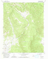
1965 Map of Chacon
USGS Topo · Published 1968About this map
Chacon and the small settlement of Lujan sit within the high-elevation valleys of the Rincon Mountains in the mid-1960s. This Northern New Mexico landscape is defined by its deep drainage systems, including Lujan Canyon, Williams Canyon, and Silva Canyon, which feed into the primary waterways. Evidence of the area's spiritual and community life is found at the El Rito Cem and San Antonio Cem located near the town centers. Much of the northern terrain is managed as part of the Carson National Forest, where high peaks give way to seasonal flows such as Little Blue Creek and Big Blue Creek. The map documents a traditional rural land use pattern where homesteads and small clusters of buildings follow the narrow, fertile valley floors beneath the steep canyon walls, connected by a network of unimproved roads and a Jeep Trail.
Find a feature on this map
19 named features on this map. Tap any name to fly to it.
Don’t see what you’re looking for? This feature index may not catch every label — zoom into the map to look around manually.
Map Details
Editions of this 1965 Chacon Map
2 editions found
Other maps of this area

1954 · Raton
USGS Topo · 1:250,000

1956 · Tooth Of Time
USGS Topo · 1:62,500

1958 · Raton
USGS Topo · 1:250,000

1965 · Osha Mountain
USGS Topo · 1:24,000

1965 · Holman
USGS Topo · 1:24,000

1965 · Shady Brook
USGS Topo · 1:24,000
1965 · Comanche Peak
USGS Topo · 1:24,000
1965 · Cerro Vista
USGS Topo · 1:24,000

1966 · Guadalupita
USGS Topo · 1:24,000
1966 · Lucero
USGS Topo · 1:24,000