
1965 Map of Holman
USGS Topo · Published 1968About this map
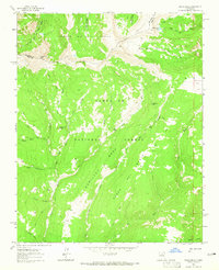
The Mora River valley carves a path through this 1960s survey of high-elevation terrain, where the rugged topography of the Carson National Forest meets the northern reaches of the Santa Fe National Forest. Small mountain settlements like Angostura and Holman are depicted along the watercourses, providing evidence of the agricultural and ranching footprint in this isolated corner of the state. The map details complex irrigation and water management, highlighting features such as La Sierra Ditch and numerous gaging stations.
Find a feature on this map
40 named features on this map. Tap any name to fly to it.
Don’t see what you’re looking for? This feature index may not catch every label — zoom into the map to look around manually.
Map Details
Editions of this 1965 Holman Map
This is the sole edition of this map. No revisions or reprints were ever made.
Other maps of this area

1889 · Las Vegas
USGS Topo · 1:125,000

1889 · Santa Fe
USGS Topo · 1:125,000

1891 · Las Vegas
USGS Topo · 1:125,000

1893 · Las Vegas
USGS Topo · 1:125,000

1894 · Santa Fe
USGS Topo · 1:125,000

1954 · Santa Fe
USGS Topo · 1:250,000

1954 · Raton
USGS Topo · 1:250,000

1958 · Raton
USGS Topo · 1:250,000

1958 · Santa Fe
USGS Topo · 1:250,000
1963 · Pecos Falls
USGS Topo · 1:24,000