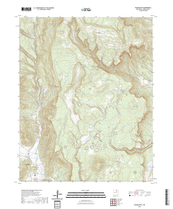
2023 Map of Guadalupita
USGS Topo · Published 2023About this map
Guadalupita rests at the southern edge of this high-elevation landscape, where the waters of Coyote Creek meet the mouth of Guadalupita Canyon. This modern survey illustrates a rugged terrain defined by massive mesas and deep drainages, including the prominent Ocate Mesa to the north and LeFebres Mesa in the east. The settlement is connected by a network of local roads like Coyote Rd and Rincon Rd, while the Guadalupita Cem serves as a significant landmark for genealogists and local historians.
Find a feature on this map
30 named features on this map. Tap any name to fly to it.
Don’t see what you’re looking for? This feature index may not catch every label — zoom into the map to look around manually.
Map Details
Editions of this 2023 Guadalupita Map
This is the sole edition of this map. No revisions or reprints were ever made.
Other maps of this area

1954 · Raton
USGS Topo · 1:250,000

1956 · Tooth Of Time
USGS Topo · 1:62,500

1958 · Raton
USGS Topo · 1:250,000

1965 · Osha Mountain
USGS Topo · 1:24,000

1965 · Chacon
USGS Topo · 1:24,000
1965 · Comanche Peak
USGS Topo · 1:24,000

1966 · Guadalupita
USGS Topo · 1:24,000
1966 · Lucero
USGS Topo · 1:24,000
1966 · Ojo Feliz
USGS Topo · 1:24,000

1966 · Ocate
USGS Topo · 1:24,000