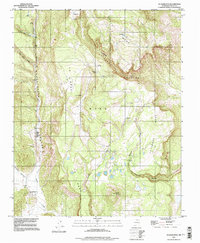
1994 Map of Guadalupita
USGS Topo · Published 1998About this map
Guadalupita serves as the primary settlement hub in this New Mexico landscape, situated at the edge of the canyon where Coyote Creek flows southward. The 1994 imagery reflects a high-altitude plateau and canyon system dominated by topographic landmarks like Ocate Mesa and La Mesa. Water management and natural springs are central to the area's geography, evidenced by features such as Cowboy Lake, numerous unnamed Springs, and a Gaging Sta along the creek.
Find a feature on this map
24 named features on this map. Tap any name to fly to it.
Don’t see what you’re looking for? This feature index may not catch every label — zoom into the map to look around manually.
Map Details
Editions of this 1994 Guadalupita Map
This is the sole edition of this map. No revisions or reprints were ever made.
Other maps of this area

1954 · Raton
USGS Topo · 1:250,000

1956 · Tooth Of Time
USGS Topo · 1:62,500

1958 · Raton
USGS Topo · 1:250,000

1965 · Osha Mountain
USGS Topo · 1:24,000

1965 · Chacon
USGS Topo · 1:24,000
1965 · Comanche Peak
USGS Topo · 1:24,000

1966 · Guadalupita
USGS Topo · 1:24,000
1966 · Lucero
USGS Topo · 1:24,000
1966 · Ojo Feliz
USGS Topo · 1:24,000

1966 · Ocate
USGS Topo · 1:24,000