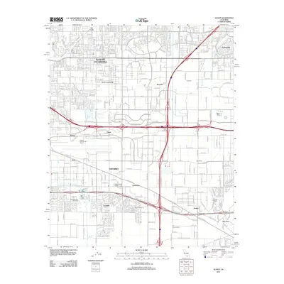
2012 Map of Guasti
USGS Topo · Published 2012About this map
The John Rains House stands as a notable landmark in this 2012 survey, situated within a densely developed landscape at the base of the San Gabriel foothills. This region shows a complex layering of suburban growth and industrial heritage, particularly evident in the presence of historic agricultural remnants like the San Antonio Winery, Flippi Winery, and Galleano Winery. These sites hint at the area's deep-rooted viticulture history, even as massive infrastructure like the Inland Empire Interchange and Ontario International Airport dominates the modern geography.
Find a feature on this map
72 named features on this map. Tap any name to fly to it.
Don’t see what you’re looking for? This feature index may not catch every label — zoom into the map to look around manually.
Map Details
Editions of this 2012 Guasti Map
This is the sole edition of this map. No revisions or reprints were ever made.
Other maps of this area

1896 · San Bernardino
USGS Topo · 1:62,500

1897 · Cucamonga
USGS Topo · 1:62,500

1898 · San Bernardino
USGS Topo · 1:62,500

1900 · Cucamonga
USGS Topo · 1:62,500

1901 · Southern California Sheet No. 1
USGS Topo · 1:250,000

1901 · San Bernardino
USGS Topo · 1:62,500

1901 · Elsinore
USGS Topo · 1:125,000

1901 · Riverside
USGS Topo · 1:62,500

1902 · Corona
USGS Topo · 1:125,000

1903 · Cucamonga
USGS Topo · 1:62,500