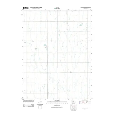
2011 Map of Guide Rock NE
USGS Topo · Published 2011About this map
Zion Cemetery and Eckley Cemetery sit among the section lines of this Webster County landscape, reflecting the distributed rural settlement pattern typical of the Nebraska plains. The terrain is defined by a series of south-flowing drainage systems, including Beaver Creek, Minnie Creek, and Soap Creek, which carve subtle valleys through the agricultural grid.
Find a feature on this map
13 named features on this map. Tap any name to fly to it.
Don’t see what you’re looking for? This feature index may not catch every label — zoom into the map to look around manually.
Map Details
Editions of this 2011 Guide Rock NE Map
This is the sole edition of this map. No revisions or reprints were ever made.
Other maps of this area

1898 · Superior
USGS Topo · 1:125,000

1955 · Grand Island
USGS Topo · 1:250,000

1957 · Grand Island
USGS Topo · 1:250,000

1958 · Grand Island
USGS Topo · 1:250,000

1960 · Deweese
USGS Topo · 1:24,000

1969 · Lawrence
USGS Topo · 1:24,000

1969 · Blue Hill
USGS Topo · 1:24,000
1974 · Amboy
USGS Topo · 1:24,000
1974 · Guide Rock
USGS Topo · 1:24,000
1974 · Mount Clare
USGS Topo · 1:24,000