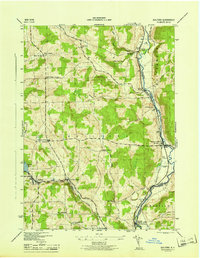
1945 Map of Guilford
USGS Topo · Published 1945About this map
The Unadilla River forms the eastern boundary of this mid-1940s landscape, serving as a corridor for industry and transit through the valley. The New York Ontario and Western railroad winds through the western terrain, connecting the settlement at Guilford with smaller hubs like Parker and Guilford Center. These rail and river routes defined the economy of the era, supporting clusters of activity at Rockwells Mills and Mount Upton.
Find a feature on this map
37 named features on this map. Tap any name to fly to it.
Don’t see what you’re looking for? This feature index may not catch every label — zoom into the map to look around manually.
Map Details
Editions of this 1945 Guilford Map
This is the sole edition of this map. No revisions or reprints were ever made.
Other maps of this area

1902 · Coventry
USGS Topo · 1:62,500

1903 · Norwich
USGS Topo · 1:62,500

1904 · Oxford
USGS Topo · 1:62,500

1910 · New Berlin
USGS Topo · 1:62,500

1912 · New Berlin
USGS Topo · 1:62,500

1915 · Unadilla
USGS Topo · 1:62,500

1918 · Unadilla
USGS Topo · 1:62,500

1943 · Sidney
USGS Topo · 1:24,000

1943 · New Berlin South
USGS Topo · 1:24,000

1943 · Gilbertsville
USGS Topo · 1:24,000