
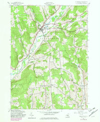
1943 Map of Gilbertsville
USGS Topo · Published 1960About this map
Butternut Creek meanders through this portion of Otsego County, anchoring a landscape defined by small agrarian settlements and family-named crossroads. The village of Gilbertsville serves as the primary hub, surrounded by a network of corners like Heslops Corner and Toll Corner that mark the intersections of rural life in the early 1940s. The mapping reveals a high density of local institutions, from School No 11 and School No 4 to various burying grounds such as Brookside Cem and Hellis Cem. The terrain rises from the creek valley toward prominent high points like Filer Hill and Sisson Hill, while the southern reaches near Unadilla Center show a transition into more heavily wooded areas around Black Ash Bog. This survey, based on 1942 aerial photography, documents the traditional Otsego County road network before late-century modernization changed the character of these rural townships.
Find a feature on this map
39 named features on this map. Tap any name to fly to it.
Don’t see what you’re looking for? This feature index may not catch every label — zoom into the map to look around manually.
Map Details
Editions of this 1943 Gilbertsville Map
2 editions found
Other maps of this area

1910 · Hartwick
USGS Topo · 1:62,500

1910 · New Berlin
USGS Topo · 1:62,500

1912 · New Berlin
USGS Topo · 1:62,500

1912 · Hartwick
USGS Topo · 1:62,500

1915 · Oneonta
USGS Topo · 1:62,500

1915 · Unadilla
USGS Topo · 1:62,500

1918 · Unadilla
USGS Topo · 1:62,500

1918 · Oneonta
USGS Topo · 1:62,500

1943 · Sidney
USGS Topo · 1:24,000

1943 · New Berlin South
USGS Topo · 1:24,000