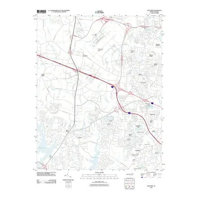
2010 Map of Guilford
USGS Topo · Published 2010About this map
Piedmont Triad International Airport dominates the central landscape of this western Guilford County region, where modern aviation infrastructure intersects with established academic and suburban communities. To the east, the historic grounds of Guilford College sit near the residential neighborhoods of Friendswood and Madison Woods. The drainage patterns are defined by the East Fork Deep River and West Fork Deep River, which feed into major reservoirs like Oak Hollow Lake and High Point Lake at the southern edge.
Find a feature on this map
87 named features on this map. Tap any name to fly to it.
Don’t see what you’re looking for? This feature index may not catch every label — zoom into the map to look around manually.
Map Details
Editions of this 2010 Guilford Map
This is the sole edition of this map. No revisions or reprints were ever made.
Other maps of this area

1949 · High Point West
USGS Topo · 1:24,000

1950 · High Point East
USGS Topo · 1:24,000

1951 · High Point East
USGS Topo · 1:24,000

1951 · Guilford
USGS Topo · 1:24,000

1951 · Lake Brandt
USGS Topo · 1:24,000

1951 · Greensboro
USGS Topo · 1:24,000

1953 · Raleigh
USGS Topo · 1:250,000

1953 · Charlotte
USGS Topo · 1:250,000

1953 · Winston-Salem
USGS Topo · 1:250,000

1953 · Greensboro
USGS Topo · 1:250,000