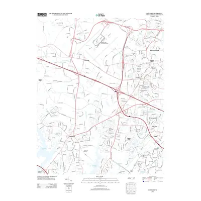
2013 Map of Guilford
USGS Topo · Published 2013About this map
Guilford College stands as a prominent cultural anchor in this western Greensboro landscape, surrounded by a dense network of residential developments and historical communities. The area is characterized by a mix of established neighborhoods like Guilford and Friendship, alongside modern infrastructure like the Piedmont Triad International Airport. The geography is defined by the headwaters of the E Fork Deep River and the W Fork Deep River, which flow south toward High Point Lake. This 2013 survey illustrates the suburban evolution of Guilford County, where named subdivisions such as Adams Farm and Sedgefield have integrated with the natural drainage basins of Horsepen Cr and Long Br. Notable recreational and community spaces, including the Uwharrie Council Camp and numerous small impoundments like Fairfield Lake and Adams Lake, are interspersed among the arterial corridors of W Friendly Ave and Bryan Blvd.
Find a feature on this map
39 named features on this map. Tap any name to fly to it.
Don’t see what you’re looking for? This feature index may not catch every label — zoom into the map to look around manually.
Map Details
Editions of this 2013 Guilford Map
This is the sole edition of this map. No revisions or reprints were ever made.
Other maps of this area

1949 · High Point West
USGS Topo · 1:24,000

1950 · High Point East
USGS Topo · 1:24,000

1951 · High Point East
USGS Topo · 1:24,000

1951 · Guilford
USGS Topo · 1:24,000

1951 · Lake Brandt
USGS Topo · 1:24,000

1951 · Greensboro
USGS Topo · 1:24,000

1953 · Raleigh
USGS Topo · 1:250,000

1953 · Charlotte
USGS Topo · 1:250,000

1953 · Winston-Salem
USGS Topo · 1:250,000

1953 · Greensboro
USGS Topo · 1:250,000