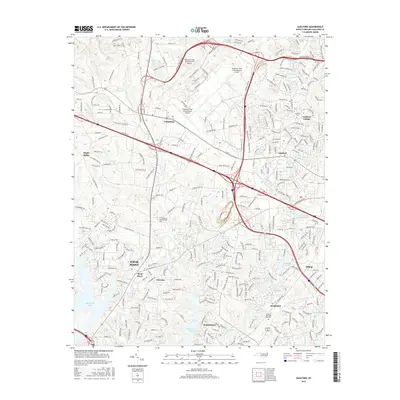
2016 Map of Guilford
USGS Topo · Published 2016About this map
Piedmont Triad International Airport dominates the northern landscape of this Guilford County quadrangle, situated at the intersection of a rapidly developing suburban and industrial corridor. The map captures the suburban expansion between High Point, Jamestown, and the western reaches of Greensboro, where residential communities like Sedgefield and Florence meet a complex network of reservoirs and creeks. To the east, the campus of Guilford College stands near the residential area of Guilford, while the southern reaches are defined by the convergence of the W Fork Deep River and E Fork Deep River feeding into High Point Lake. This 2016 survey documents a landscape of managed water and modern infrastructure, featuring numerous private and company-owned water bodies such as Daniel Lumber Company Lake and Uwharrie Lake.
Find a feature on this map
285 named features on this map. Tap any name to fly to it.
Don’t see what you’re looking for? This feature index may not catch every label — zoom into the map to look around manually.
Map Details
Editions of this 2016 Guilford Map
This is the sole edition of this map. No revisions or reprints were ever made.
Other maps of this area

1949 · High Point West
USGS Topo · 1:24,000

1950 · High Point East
USGS Topo · 1:24,000

1951 · High Point East
USGS Topo · 1:24,000

1951 · Guilford
USGS Topo · 1:24,000

1951 · Lake Brandt
USGS Topo · 1:24,000

1951 · Greensboro
USGS Topo · 1:24,000

1953 · Raleigh
USGS Topo · 1:250,000

1953 · Charlotte
USGS Topo · 1:250,000

1953 · Winston-Salem
USGS Topo · 1:250,000

1953 · Greensboro
USGS Topo · 1:250,000