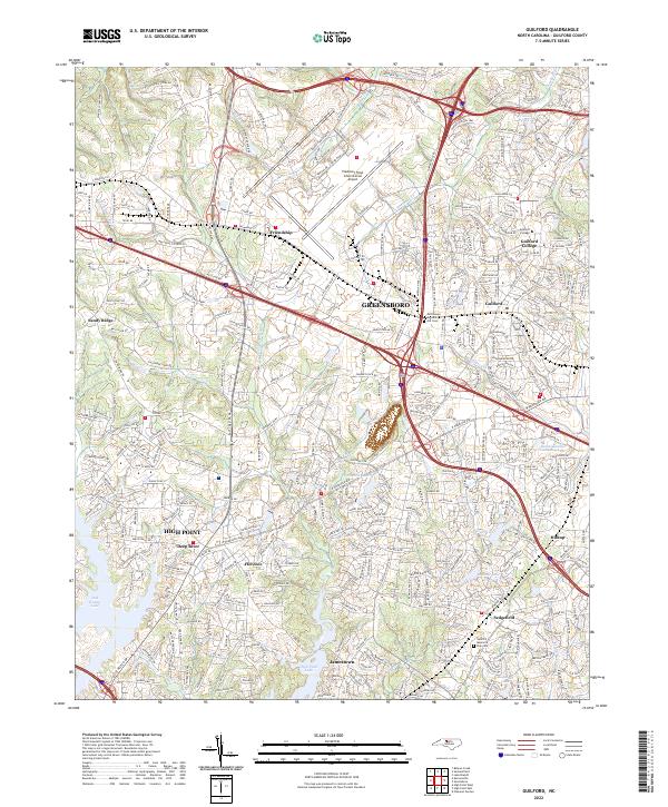
2022 Map of Guilford
USGS Topo · Published 2022About this map
Greensboro and the surrounding Piedmont landscape are defined here by a dense network of suburban expansion and industrial infrastructure. The area is anchored by the historic campus of Guilford College and the expansive facilities of the Piedmont Triad International Airport. The topography is shaped by the headwaters of the Deep River system, including the E Fork Deep River and W Fork Deep River, alongside numerous reservoirs such as Oak Hollow Lake and Fairfield Lake. Smaller, established communities like Friendship, Florence, and Jamestown are visible among the interlaced thoroughfares of W Market St and W Wendover Ave. Genealogy researchers can locate several significant sites, including the Persimmon Grove A M E Cem and the Guilford Memorial Park Cem, situated amidst the growing residential developments of Sedgefield and Hilltop.
Find a feature on this map
35 named features on this map. Tap any name to fly to it.
Don’t see what you’re looking for? This feature index may not catch every label — zoom into the map to look around manually.
Map Details
Editions of this 2022 Guilford Map
This is the sole edition of this map. No revisions or reprints were ever made.
Other maps of this area

1949 · High Point West
USGS Topo · 1:24,000

1950 · High Point East
USGS Topo · 1:24,000

1951 · High Point East
USGS Topo · 1:24,000

1951 · Guilford
USGS Topo · 1:24,000

1951 · Lake Brandt
USGS Topo · 1:24,000

1951 · Greensboro
USGS Topo · 1:24,000

1953 · Raleigh
USGS Topo · 1:250,000

1953 · Charlotte
USGS Topo · 1:250,000

1953 · Winston-Salem
USGS Topo · 1:250,000

1953 · Greensboro
USGS Topo · 1:250,000