
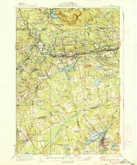
1937 Map of Guilford
USGS Topo · Published 1937About this map
The Piscataquis River corridor serves as the industrial and social backbone of this Central Maine landscape during the mid-1930s. The manufacturing hub of Guilford and nearby Sangerville anchor the region, connected by the Bangor and Aroostook Railroad and a network of early state roads including Route No 15. The transit of timber and textiles is evidenced by the proximity of the rail line to the river, with key crossings like Lows Bridge providing vital links between the rural uplands and valley settlements.
Find a feature on this map
132 named features on this map. Tap any name to fly to it.
Don’t see what you’re looking for? This feature index may not catch every label — zoom into the map to look around manually.
Map Details
Editions of this 1937 Guilford Map
2 editions found
Other maps of this area

1913 · Skowhegan
USGS Topo · 1:62,500

1930 · Pittsfield
USGS Topo · 1:48,000

1931 · Stetson
USGS Topo · 1:48,000

1932 · Dover-Foxcroft
USGS Topo · 1:48,000

1932 · Pittsfield
USGS Topo · 1:62,500

1933 · Pittsfield
USGS Topo · 1:62,500

1933 · Guilford
USGS Topo · 1:62,500

1935 · Dover-Foxcroft
USGS Topo · 1:62,500

1935 · Stetson
USGS Topo · 1:62,500

1940 · Sebec
USGS Topo · 1:48,000