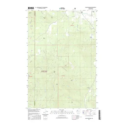
2017 Map of Guler Mountain
USGS Topo · Published 2017About this map
The settlements of Guler and Trout Lake anchor the northern landscape of this 2017 survey, where the Trout Lake Valley meets the high ridges of the Cascades. The topography is defined by significant volcanic and glacial features, including the Lava Bridge and the Monte Cristo Range. Waterways such as the White Salmon River and Little White Salmon River drain the high country, carving through distinct terrain like Kilowatt Canyon and Wang Canyon.
Find a feature on this map
61 named features on this map. Tap any name to fly to it.
Don’t see what you’re looking for? This feature index may not catch every label — zoom into the map to look around manually.
Map Details
Editions of this 2017 Guler Mountain Map
This is the sole edition of this map. No revisions or reprints were ever made.
Other maps of this area

1904 · Mount Adams
USGS Topo · 1:125,000

1907 · Mount Adams
USGS Topo · 1:125,000

1926 · Steamboat Mtn
USGS Topo · 1:125,000

1926 · Hood River
USGS Topo · 1:125,000

1929 · Hood River
USGS Topo · 1:125,000

1931 · Steamboat Mtn
USGS Topo · 1:125,000

1934 · The Dalles
USGS Topo · 1:125,000

1950 · Yakima
USGS Topo · 1:250,000

1953 · The Dalles
USGS Topo · 1:250,000

1956 · The Dalles
USGS Topo · 1:250,000