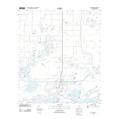
2011 Map of Gulf Shores
USGS Topo · Published 2011About this map
Bon Secour and the surrounding Baldwin County coastline are defined by a complex network of bayous and rivers leading into Oyster Bay. This early 21st-century survey documents the transition from maritime and agricultural roots to a modern resort landscape. While the Bon Secour River and Boggy Branch show the natural hydrology of the area, the map also captures an extensive energy infrastructure with numerous gas fields, such as the South Foley Gas Field and Brights Creek Gas Field, interspersed with residential growth. Local aviation and tourism hubs are prominent, including the Jack Edwards Airport and the Alabama Gulf Coast Zoo. Near the shore of Little Lagoon, the Wallace Cemetery serves as a genealogical marker amidst the developing vacation properties and recreational sites like the Waterville USA Water Park and Craft Farms Resort.
Find a feature on this map
78 named features on this map. Tap any name to fly to it.
Don’t see what you’re looking for? This feature index may not catch every label — zoom into the map to look around manually.
Map Details
Editions of this 2011 Gulf Shores Map
This is the sole edition of this map. No revisions or reprints were ever made.
Other maps of this area

1921 · Bon Secour
USGS Topo · 1:62,500

1921 · Point Clear
USGS Topo · 1:62,500

1941 · Foley
USGS Topo · 1:62,500

1941 · Weeks Bay
USGS Topo · 1:62,500

1943 · Weeks Bay
USGS Topo · 1:62,500

1943 · Foley
USGS Topo · 1:62,500

1944 · Miflin
USGS Topo · 1:25,000

1957 · Pensacola
USGS Topo · 1:250,000

1959 · Pensacola
USGS Topo · 1:250,000

1960 · Pensacola
USGS Topo · 1:250,000