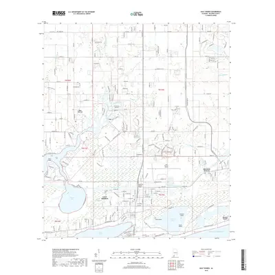
2018 Map of Gulf Shores
USGS Topo · Published 2018About this map
Gulf Shores and Orange Beach anchor this coastal landscape, situated along the southern edge of Baldwin County where the Intracoastal Waterway cuts through the mainland. The geography is defined by a complex network of brackish water bodies, including Oyster Bay, Little Lagoon, and the Shelby Lakes within the coastal interior. The Doctor W C Holmes Bridge serves as a critical connection over the canal, linking the mainland to the beachfront developments. To the northwest, the settlement of Bon Secour sits near the mouth of the Bon Secour River, an area with deep ties to the region's maritime history. Smaller communities like Oak and landmarks such as the Wallace Cem provide grounded points for genealogical research. The transition from the established grid of Gulf Shores to the marshy expanses of Grass Island and Alligator Island reflects the persistent balance between modern coastal infrastructure and the natural hydrologic systems of the Gulf coast.
Find a feature on this map
54 named features on this map. Tap any name to fly to it.
Don’t see what you’re looking for? This feature index may not catch every label — zoom into the map to look around manually.
Map Details
Editions of this 2018 Gulf Shores Map
This is the sole edition of this map. No revisions or reprints were ever made.
Other maps of this area

1921 · Bon Secour
USGS Topo · 1:62,500

1921 · Point Clear
USGS Topo · 1:62,500

1941 · Foley
USGS Topo · 1:62,500

1941 · Weeks Bay
USGS Topo · 1:62,500

1943 · Weeks Bay
USGS Topo · 1:62,500

1943 · Foley
USGS Topo · 1:62,500

1944 · Miflin
USGS Topo · 1:25,000

1957 · Pensacola
USGS Topo · 1:250,000

1959 · Pensacola
USGS Topo · 1:250,000

1960 · Pensacola
USGS Topo · 1:250,000