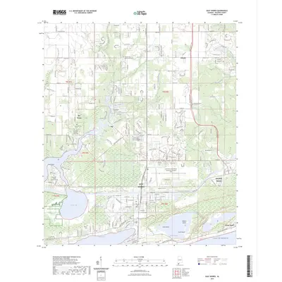
2024 Map of Gulf Shores
USGS Topo · Published 2024About this map
Gulf Shores and Foley dominate this modern coastal landscape, where the Intracoastal Waterway cuts a distinct path between the mainland and the barrier peninsula. The area maintains a unique blend of established residential growth and protected wetlands, exemplified by the extensive Bon Secour National Wildlife Refuge bordering Oyster Bay. Smaller settlements like Bon Secour and Oak are punctuated by numerous local burial grounds, including the Witt Brown Cem and Wallace Cem, offering valuable data for genealogists tracing family histories in southern Baldwin County.
Find a feature on this map
76 named features on this map. Tap any name to fly to it.
Don’t see what you’re looking for? This feature index may not catch every label — zoom into the map to look around manually.
Map Details
Editions of this 2024 Gulf Shores Map
This is the sole edition of this map. No revisions or reprints were ever made.
Other maps of this area

1921 · Bon Secour
USGS Topo · 1:62,500

1921 · Point Clear
USGS Topo · 1:62,500

1941 · Foley
USGS Topo · 1:62,500

1941 · Weeks Bay
USGS Topo · 1:62,500

1943 · Weeks Bay
USGS Topo · 1:62,500

1943 · Foley
USGS Topo · 1:62,500

1944 · Miflin
USGS Topo · 1:25,000

1957 · Pensacola
USGS Topo · 1:250,000

1959 · Pensacola
USGS Topo · 1:250,000

1960 · Pensacola
USGS Topo · 1:250,000