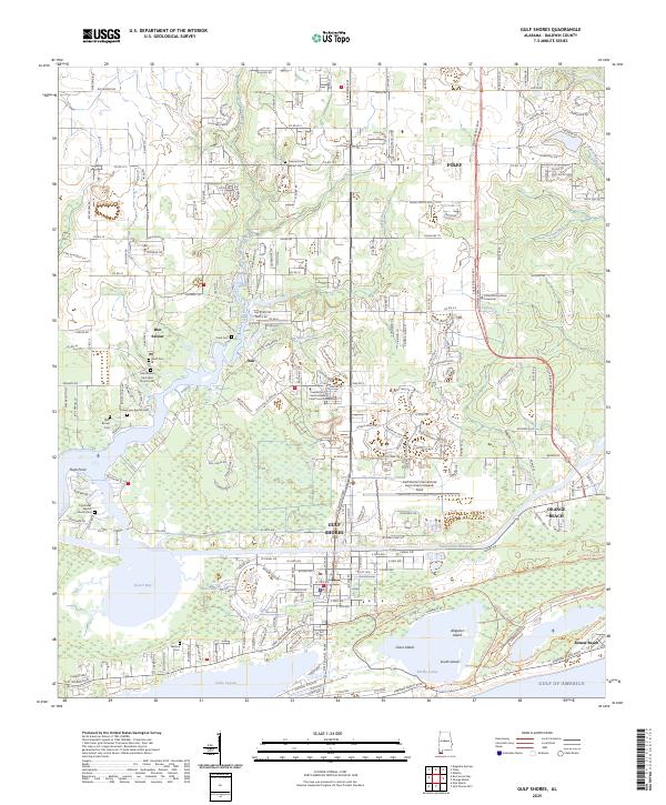
2025 Map of Gulf Shores
USGS Topo · Published 2025About this map
Gulf Shores and Orange Beach anchor this coastal landscape where the Intracoastal Waterway carves a path between the northern bayous and the lagoons of the Gulf of Mexico. This contemporary survey details the complex interface of wetlands and rapid development, from the fishing heritage near Bon Secour and the Bon Secour River to the aviation hub at Gulf Shores International Airport. Genealogists will find a high density of burial sites preserved amidst modern growth, including the Pleasant View Baptist Church Cem and the small Witt - Brown Cem. The map illustrates how transportation corridors like Fort Morgan Rd and Perdido Beach Blvd define the shoreline, while protected areas around Shelby Lakes and Grass Island preserve the original maritime character of Baldwin County.
Find a feature on this map
50 named features on this map. Tap any name to fly to it.
Don’t see what you’re looking for? This feature index may not catch every label — zoom into the map to look around manually.
Map Details
Editions of this 2025 Gulf Shores Map
This is the sole edition of this map. No revisions or reprints were ever made.
Other maps of this area

1921 · Bon Secour
USGS Topo · 1:62,500

1921 · Point Clear
USGS Topo · 1:62,500

1941 · Foley
USGS Topo · 1:62,500

1941 · Weeks Bay
USGS Topo · 1:62,500

1943 · Weeks Bay
USGS Topo · 1:62,500

1943 · Foley
USGS Topo · 1:62,500

1944 · Miflin
USGS Topo · 1:25,000

1957 · Pensacola
USGS Topo · 1:250,000

1959 · Pensacola
USGS Topo · 1:250,000

1960 · Pensacola
USGS Topo · 1:250,000