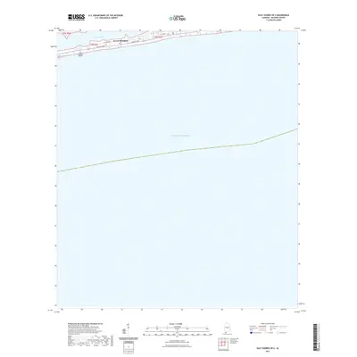
2021 Map of Gulf Shores OE S
USGS Topo · Published 2021About this map
Gulf Shores occupies a narrow coastal strip in this recent 2021 topographic study, positioned between the expansive Gulf of Mexico and the protected waters of Little Lagoon. The map illustrates a dense grid of residential and commercial access points along the shoreline, centered on the primary thoroughfares of W Beach Blvd and E Beach Blvd. This late-date survey by the U.S. Geological Survey captures the modern development footprint of this Alabama resort community, highlighting the precise shoreline alignment and street-level layout including W Lagoon Ave and W 1st Ave. The composition of the landscape is defined by this thin barrier of land, where the transition from the lagoon to the open sea is managed by a strictly organized network of local roads and property boundaries.
Find a feature on this map
9 named features on this map. Tap any name to fly to it.
Don’t see what you’re looking for? This feature index may not catch every label — zoom into the map to look around manually.
Map Details
Editions of this 2021 Gulf Shores OE S Map
This is the sole edition of this map. No revisions or reprints were ever made.
Other maps of this area

1921 · Bon Secour
USGS Topo · 1:62,500

1921 · Point Clear
USGS Topo · 1:62,500

1941 · Foley
USGS Topo · 1:62,500

1941 · Weeks Bay
USGS Topo · 1:62,500

1943 · Weeks Bay
USGS Topo · 1:62,500

1943 · Foley
USGS Topo · 1:62,500

1944 · Miflin
USGS Topo · 1:25,000

1957 · Pensacola
USGS Topo · 1:250,000

1959 · Pensacola
USGS Topo · 1:250,000

1960 · Pensacola
USGS Topo · 1:250,000