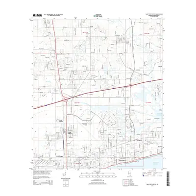
2015 Map of Gulfport North
USGS Topo · Published 2015About this map
Gulfport and its northern suburbs are defined by the convergence of the coastal shoreline and the interior river systems of the Mississippi Sound. The southern edge of the map follows the developed beach along E Beach Blvd, passing through Mississippi City and De Buys, while the interior transitions into a network of bayous and creeks. The Bayou Bernard serves as a major geographical divider, separating the dense grid of West Gulfport and Handsboro from northern residential communities like Orange Grove and Landon. The massive footprint of the Gulfport-Biloxi International Airport dominates the central landscape, showing how the mid-century aviation era reshaped the traditional patterns of Harrison County. Genealogists and local historians will find several established burial grounds, including Evergreen Cem, Handsboro Cem, and Floral Hills Cem, which document the long-standing families of this coastal hub.
Find a feature on this map
46 named features on this map. Tap any name to fly to it.
Don’t see what you’re looking for? This feature index may not catch every label — zoom into the map to look around manually.
Map Details
Editions of this 2015 Gulfport North Map
This is the sole edition of this map. No revisions or reprints were ever made.
Other maps of this area

1953 · Mobile
USGS Topo · 1:250,000

1954 · Vestry
USGS Topo · 1:62,500

1954 · McHenry
USGS Topo · 1:62,500

1954 · Gulfport North
USGS Topo · 1:24,000

1954 · Gulfport South
USGS Topo · 1:24,000

1954 · Biloxi
USGS Topo · 1:24,000

1954 · Biloxi
USGS Topo · 1:62,500

1955 · Pass Christian
USGS Topo · 1:24,000

1956 · Gulfport NW
USGS Topo · 1:24,000

1957 · Mobile
USGS Topo · 1:250,000