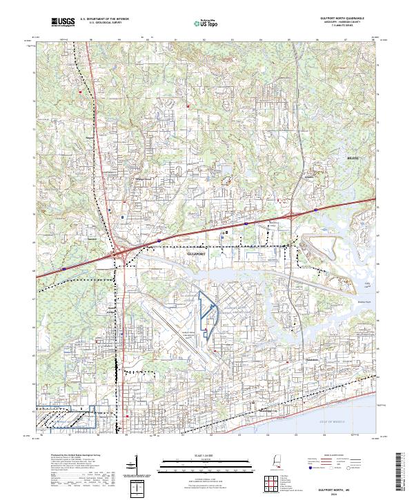
2024 Map of Gulfport North
USGS Topo · Published 2024About this map
The Gulf of Mexico shoreline and the complex drainage of the Biloxi River define this coastal landscape, which integrates historic maritime settlements with modern aviation infrastructure. Established communities such as Handsboro and Mississippi City line the southern edge, while the inland areas show the growth of Orange Grove and Nugent. The presence of Hesters Ferry on the Little Biloxi River hints at older river-crossing traditions that preceded the intensive road networks of t7s r11w and t7s r10w. Large-scale regional logistics are centered around the Gulfport-Biloxi International Airport and the NG Gulfport AVCRAD facility. Genealogists will find notable burial grounds including Evergreen Cem and Floral Hills Cem situated amidst the numerous bayous like Brickyard Bayou and Turkey Creek that thread through the low-lying terrain.
Find a feature on this map
50 named features on this map. Tap any name to fly to it.
Don’t see what you’re looking for? This feature index may not catch every label — zoom into the map to look around manually.
Map Details
Editions of this 2024 Gulfport North Map
This is the sole edition of this map. No revisions or reprints were ever made.
Other maps of this area

1953 · Mobile
USGS Topo · 1:250,000

1954 · Vestry
USGS Topo · 1:62,500

1954 · McHenry
USGS Topo · 1:62,500

1954 · Gulfport North
USGS Topo · 1:24,000

1954 · Gulfport South
USGS Topo · 1:24,000

1954 · Biloxi
USGS Topo · 1:24,000

1954 · Biloxi
USGS Topo · 1:62,500

1955 · Pass Christian
USGS Topo · 1:24,000

1956 · Gulfport NW
USGS Topo · 1:24,000

1957 · Mobile
USGS Topo · 1:250,000