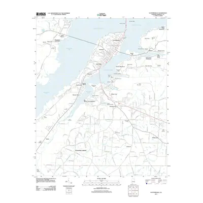
2011 Map of Guntersville
USGS Topo · Published 2011About this map
Guntersville serves as the focal point of this riverfront landscape, situated where the Tennessee River expands into the wide reaches of Guntersville Lake. The town's layout is defined by its relationship with the water, featuring several docks and facilities such as the Guntersville Marina and Val Monte Marina. The Houston Bridge provides a vital link across the water, connecting the northern shore near Gunters Reef to the developed peninsula.
Find a feature on this map
185 named features on this map. Tap any name to fly to it.
Don’t see what you’re looking for? This feature index may not catch every label — zoom into the map to look around manually.
Map Details
Editions of this 2011 Guntersville Map
This is the sole edition of this map. No revisions or reprints were ever made.
Other maps of this area

1885 · Gadsden
USGS Topo · 1:125,000

1888 · Gadsden
USGS Topo · 1:125,000

1892 · Gadsden
USGS Topo · 1:125,000

1895 · Gadsden
USGS Topo · 1:125,000

1903 · Gadsden
USGS Topo · 1:125,000

1936 · Guntersville
USGS Topo · 1:24,000

1936 · Mountainboro
USGS Topo · 1:24,000

1936 · Columbus City
USGS Topo · 1:24,000

1936 · Guntersville Dam
USGS Topo · 1:24,000

1936 · Arab
USGS Topo · 1:24,000
Featured Places
- Albertville, AL
- Guntersville, AL
- Lindsay Lane, Guntersville
- Mountain View, Guntersville
- Rayburn, Guntersville